
The ArcGIS Pro Associate certification, exam code EAPA_2025, is Esri’s mid-tier credential for people who use ArcGIS Pro as part of their working week rather than as a subject they are learning. That distinction is the whole design of the exam. Esri sorts its technical certifications into three experience bands, and Associate sits at two to four years. Sit it with six months of coursework behind you and the scenario questions will feel like they are written in a language you half know. Sit it after three years of real projects and the same questions read as descriptions of Tuesday. The paper is 75 questions in 90 minutes for $295, delivered through Pearson VUE, and its four skills areas carry published weightings that tell you exactly where to spend your preparation.
What Does the ArcGIS Pro Associate Certification Actually Test?
It tests applied competence in the ArcGIS Pro desktop application: managing geospatial data, symbolising and querying it, running geoprocessing workflows, and getting the result out as a map, layout or shared item. The questions are framed as workplace scenarios, not definitions, and they assume you have made these decisions on real projects.
Read the objective list and a pattern emerges immediately. Phrase after phrase begins “given a scenario”. Given a scenario, determine the appropriate geoprocessing tool. Given a scenario, apply a query. Given a scenario, determine the appropriate existing geodatabase elements to use. Esri is not asking whether you know the tool exists. It is asking whether you would reach for that one.
Where it sits among Esri’s exams
Esri runs a wide certification programme covering ArcGIS Pro, ArcGIS Enterprise, ArcGIS Online, developer APIs and the utility network. This exam covers only ArcGIS Pro, and only at the applied level. It does not test enterprise administration, it does not test scripting beyond recognising when a script or model is the right approach, and it does not test the web platform. If your day is spent administering an ArcGIS Enterprise deployment, this is the wrong paper. For readers newer to the field, geographic information systems as a discipline sit behind everything the exam touches, and the vocabulary is worth having straight before you start.
What Is on the EAPA_2025 Exam, and What Does It Cost?
The exam is 75 questions in 90 minutes, priced at $295 USD, scheduled through Pearson VUE and reported as a pass or fail rather than a percentage. It covers four skills areas, and unlike many vendor exams, Esri publishes a weighting for each one. That single fact makes planning far easier than it is on most certification papers.
| Exam detail | Value |
|---|---|
| Certification | Esri Certified ArcGIS Pro Associate 2025 |
| Exam code | EAPA_2025 |
| Questions | 75 |
| Duration | 90 minutes |
| Price | $295 USD |
| Result | Pass or fail |
| Delivery | Pearson VUE, test centre or online |
| Language | English |
Seventy-five questions in 90 minutes gives you 72 seconds each. That is tighter than it looks, because scenario stems take time to read. The compensation is that the weightings let you know in advance which areas are worth the most, so nothing on the paper should be a surprise.
| Skills area | Weight | Roughly how many questions |
|---|---|---|
| Data Management | 32% | 24 |
| Visualization | 25% | 19 |
| Analysis and Geoprocessing | 25% | 19 |
| Layouts and Sharing | 18% | 13 |
The exam was published in January 2025 and is offered in English. Esri refreshes its certification exams on a cycle of roughly eighteen to twenty-four months so that they track current ArcGIS releases, which is worth knowing if you are deciding whether to sit now or wait. Programme mechanics are documented on the Esri certification programme pages.
Why Is Data Management Almost a Third of the Exam?
Because it is where GIS work goes wrong. Data Management carries 32% of EAPA_2025, the largest of the four areas, and it covers raster, vector and tabular data, coordinate systems, geodatabase element selection, and editing features and attributes. Every downstream task in the other three areas depends on getting these right first.
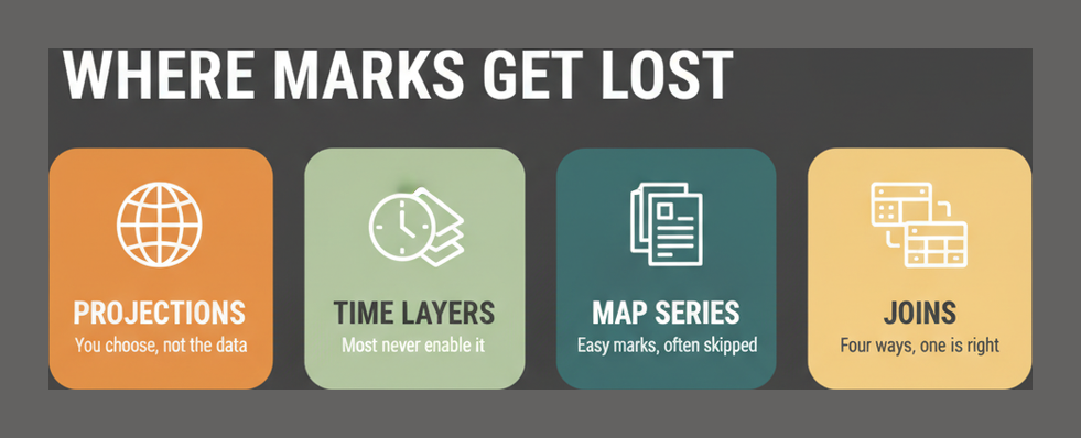
The coordinate system objective is worded carefully: manage coordinate systems to preserve the desired spatial properties. That is not a question about knowing what a projection is. It is a question about knowing that a projection preserving area will distort distance, and choosing accordingly for the task in front of you. Candidates who have only ever accepted whatever coordinate system a dataset arrived in tend to lose marks here.
The geodatabase question type
The syllabus asks you to determine the appropriate existing geodatabase elements to use for a given scenario. In practice that means knowing when a feature dataset, a subtype, a domain, a relationship class or an attribute rule is the correct structure, and being able to say why one is better than another for a stated requirement. It rewards people who have designed a schema rather than merely populated one.
- Raster against vector storage decisions and when each is appropriate
- Domains and subtypes as a way of enforcing data quality at entry
- Editing workflows, including what happens to related records
- Tabular data and how it joins into the spatial model
Full behaviour of every one of these is documented in the ArcGIS Pro documentation, which is the reference to keep open while you revise this area.
What Do Visualization and Layouts Ask For?
Together these two areas are 43% of the paper. Visualization at 25% covers layer properties, geographic transformations, querying, and displaying temporal, ranged and 3D data. Layouts and Sharing at 18% covers exporting maps and scenes to different formats, creating and managing layouts and map series, and choosing how to share content out of ArcGIS Pro.
The two areas are separated in the blueprint but joined in practice: you symbolise something in order to publish it. Treating them as one revision block is more efficient than working through them separately.
The parts people underestimate
Geographic transformations appear in the Visualization objectives rather than in Data Management, which surprises people. If two layers in different datums are not aligning, the fix is a transformation, and the exam expects you to know where that control lives. Temporal and 3D display is the other commonly thin spot, because plenty of working analysts have never enabled time on a layer or opened a scene.
Map series get less attention than they deserve for an 18% area. Knowing how to drive a layout from an index layer, and what changes page to page, is directly examinable and quick to learn if you have never built one.
How Deep Does the Analysis and Geoprocessing Section Go?
Not as deep as its name suggests, but broader. At 25% it covers choosing the right geoprocessing tool for a scenario, comparing table joins, relates, relationship classes and spatial joins, executing complex workflows with tasks, batch processing, models or scripts, and applying raster functions for image processing.
The joins comparison is the standout question type, because four mechanisms overlap and each has a case where it is the only correct answer. A join and a relate differ in cardinality. A relationship class persists in the geodatabase where a relate does not. A spatial join answers a question about location rather than a shared key. Being able to state those distinctions cleanly covers a meaningful share of the area.
Automation, but only at the level of choosing it
You are asked to use tasks, batch processing, models or scripts to execute a complex workflow. Note the framing: the exam wants you to select the right automation mechanism for the situation, not to write Python under time pressure. A ModelBuilder model is right for a repeatable spatial workflow you want colleagues to run. A script is right when the logic outgrows what a model can express. A task is right when a human needs guiding through steps. Knowing which is which matters more than syntax.
Raster functions round the area out. They are the on-the-fly alternative to running a raster tool and writing a new dataset, and knowing why you would choose one over the other is exactly the kind of judgement this exam rewards.
Which Esri Certification Level Fits Your Experience?
Esri publishes experience bands for its three levels, and they are unusually direct. Foundation is aimed at zero to two years, Associate at two to four years, and Professional at four or more. The ArcGIS Pro track offers all three, so choosing the right one is mostly a matter of being honest about how long you have been doing the work.
| Level | Experience band | What it suits |
|---|---|---|
| Foundation | 0 to 2 years | Recent graduates and career changers proving core competence |
| Associate | 2 to 4 years | Working analysts applying ArcGIS Pro across real projects |
| Professional | 4 or more years | Specialists leading design and complex workflow decisions |
The common mistake is skipping Foundation on the assumption it is trivial. If your ArcGIS Pro use is regular but narrow, one workflow repeated often, Foundation may genuinely be the better match, and a pass is worth more than a near miss at the level above. If you are weighing that choice, the ArcGIS Pro Foundation route sets out what the lower tier expects, and the wider Esri certification catalogue shows how the tracks fit together.
Esri’s own view of who each level is for, along with the programme’s exam refresh cadence, is set out on its certification programme board.
Is the ArcGIS Pro Associate Certification Worth It for a GIS Career?
It is worth most to people who need to prove competence to someone who cannot watch them work: a hiring manager, a procurement panel, or a client evaluating a consultancy. Esri certification is widely recognised in the GIS labour market because Esri software dominates it, so the credential functions as a common reference point that a portfolio does not always provide.
Where it is worth less is inside an organisation that already knows what you can do. If your manager has three years of your project work to look at, a certificate adds little. The exception is procurement: consultancies bidding for public sector GIS work are frequently asked how many certified staff they employ, and that turns individual credentials into commercial value.
What the roles look like
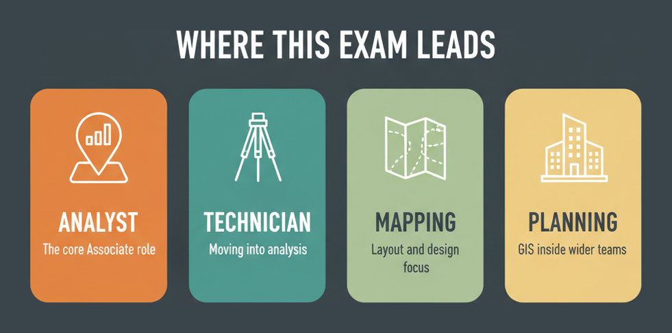
- GIS analyst, the most common destination and the role the Associate band describes
- GIS technician moving toward analysis rather than data capture
- Cartographer or mapping specialist, where the Visualization and Layouts areas map directly onto the job
- Utility, environmental or planning roles where GIS is one tool among several
Pay varies widely by sector and region, and public sector GIS pay differs sharply from utilities or private consultancy. Current benchmarks for the analyst role are tracked on PayScale GIS analyst data, which is a more useful reference point than any single figure quoted in an article.
How Should You Prepare for 75 Questions in 90 Minutes?
Let the weightings drive the plan. Data Management is 32% of the paper and deserves roughly a third of your time; Layouts and Sharing is 18% and deserves roughly a fifth. Within each area, prioritise the objectives you have never had a project reason to touch, because the exam draws on all of them regardless of what your work happens to involve.
- Map your own project history against the four skills areas first, marking every objective you have genuinely done, so the gaps rather than the strengths set your study plan.
- Spend the largest block on Data Management, since it is 32% of the exam and the area where a weak coordinate system or geodatabase answer costs the most marks.
- Deliberately build a geodatabase with domains, subtypes and a relationship class, because the exam asks you to choose between these elements and the choice only becomes obvious once you have created them.
- Practise the joins comparison directly, working through a table join, a relate, a relationship class and a spatial join on the same data so the differences in cardinality and persistence are concrete.
- Enable time on a layer and open a scene if you never have, since temporal and 3D display sits inside the 25% Visualization area and is a common blind spot.
- Build one map series from an index layer, which is the fastest way to cover a disproportionate share of the Layouts and Sharing objectives.
- Finish with timed practice at about 72 seconds a question, tracking wrong answers by skills area so you can see which of the four still needs work.
When you are ready to check where you stand, the EAPA_2025 exam page collects the exam details and practice material in one place.
Frequently Asked Questions
How many questions are on the ArcGIS Pro Associate exam?
There are 75 questions and the time limit is 90 minutes, which works out at about 72 seconds each. The questions are scenario-based, so a fair share of that time is spent reading rather than deciding.
How much does the ArcGIS Pro Associate certification cost?
The exam is $295 USD. It is booked and paid for through Pearson VUE, and you can sit it either at a test centre or online, so there is no separate proctoring charge to budget for.
What are the exam domains and their weightings?
Four areas: Data Management at 32%, Visualization at 25%, Analysis and Geoprocessing at 25%, and Layouts and Sharing at 18%. Data Management is the largest single area and should take the largest share of study time.
What is the difference between ArcGIS Pro Foundation and Associate?
Experience level. Foundation targets zero to two years and core competence; Associate targets two to four years and applied judgement across real projects. They are separate exams, and Foundation is not a prerequisite for Associate.
Do you need Python for this exam?
Not in the sense of writing code under time pressure. The blueprint asks you to choose between tasks, batch processing, models and scripts for a given workflow, so you need to know when a script is the right answer rather than how to write one.
Is there a passing percentage?
Esri reports the outcome as pass or fail and does not publish a percentage threshold. Since the four weightings are published, the practical approach is even coverage weighted toward Data Management rather than targeting a number.
What ArcGIS Pro version is the exam based on?
The exam was published in January 2025 and is built around the ArcGIS Pro release current at that point. Esri refreshes certification exams roughly every eighteen to twenty-four months to keep them aligned with the software.
Where do you book the ArcGIS Pro Associate exam?
Through Pearson VUE. You create an account, choose either a test centre or an online proctored session, and schedule from there. The Esri certification pages link straight into the booking flow.
How much experience should you have before sitting it?
Esri places the Associate level at two to four years of applied ArcGIS Pro work. There is no enforced prerequisite, but the scenario framing of the questions genuinely assumes project experience rather than coursework.
Which area do candidates find hardest?
Usually coordinate systems and geographic transformations, because many analysts have only ever accepted the projection a dataset arrived with. Temporal and 3D visualisation runs a close second for the same reason.
Conclusion
The published weightings are the most useful thing about this exam, and most candidates ignore them. Data Management is nearly a third of the paper; Layouts and Sharing is under a fifth. A study plan that reflects that split, and that targets the objectives your projects have never made you use, is worth more than another pass through material you already know. Be honest about the experience band too: two to four years is Esri’s own description of who Associate is for, and Foundation is not a lesser achievement if it matches where you actually are. When your coverage looks even against the four areas, move to timed practice and let the results tell you which one still needs work.


